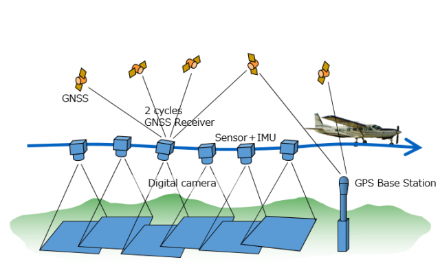
Aerial surveys
Enable high-resolution aerial photography and high-accuracy orthophoto creation.
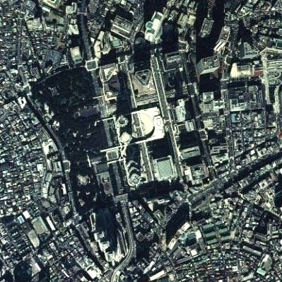
We take the ultra-high-resolution images from the aircraft.
At the same time the exact location shooting and measured, to obtain the data required.
We are equipped with the 190 millions of pixels airborne camera (UltraCamXp WA) to the aircraft.
We are taking an image of the ultra-high resolution.
Not only the quality of the captured image, also has earned a high evaluation accuracy of such acquired location information.
In addition to create a high-precision photo map expressing seamlessly aerial photographs.