Survey service

Airborne laser surveys

The latest technique only in NAKANIHON AIR which can acquire high-density and extensive topography data in a short term

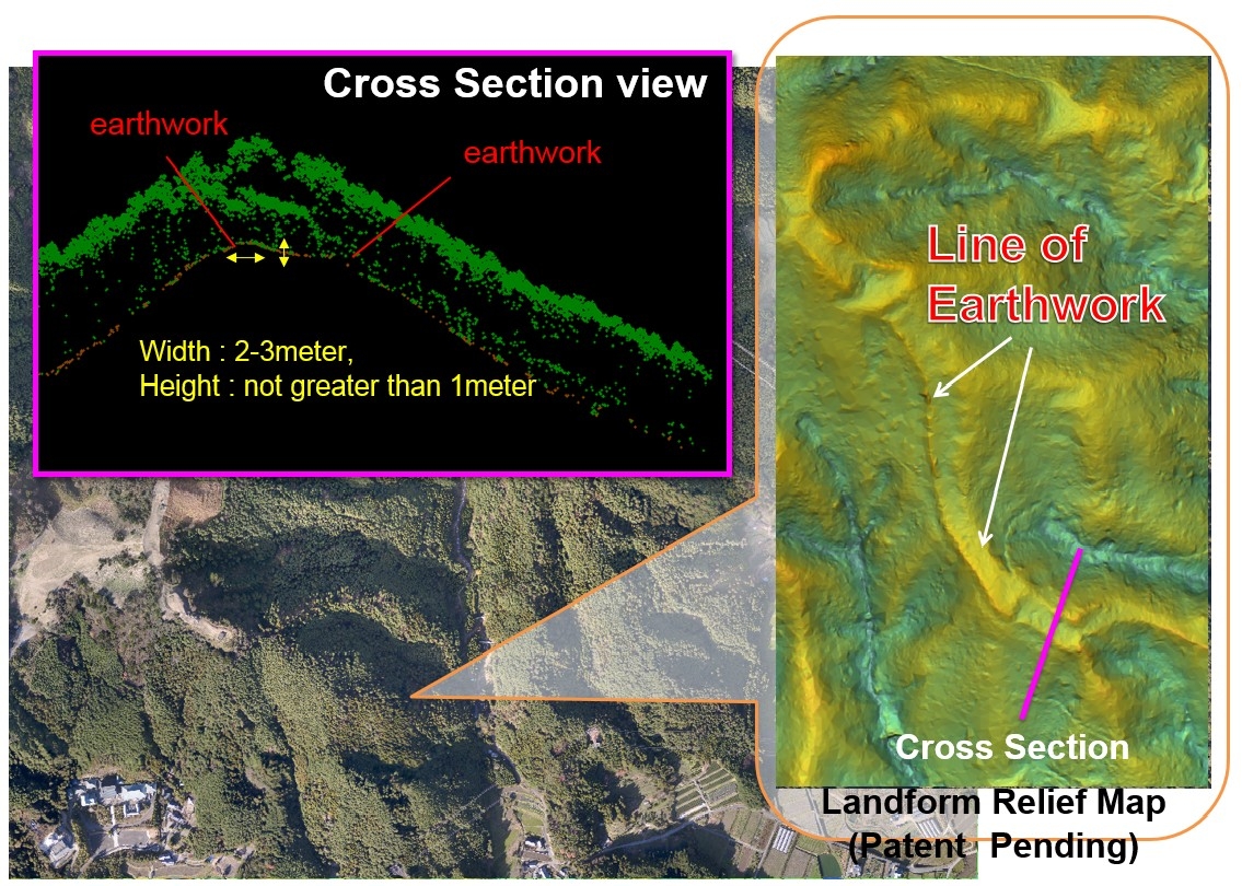
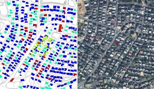
NAKANIHON AIR takes scanning an earth surface using airborne laser system and makes the exact three-dimensional topography model.
Particularly, it is effective as analysis documents of a mountainous area or the danger area and contributes to the scenery simulation by the development design.
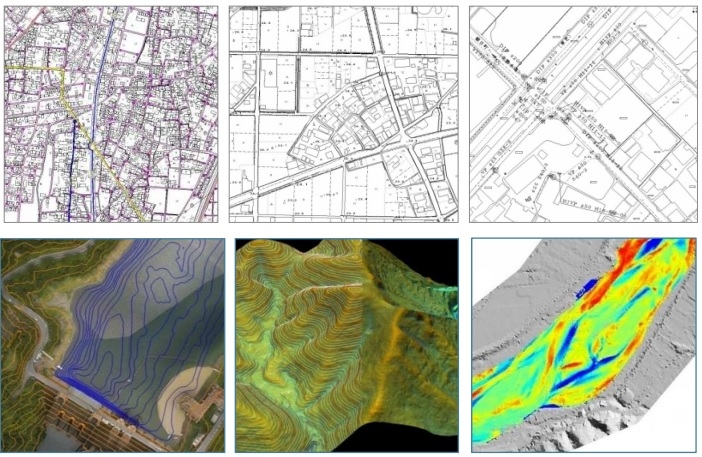
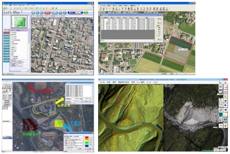
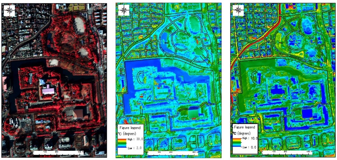
We perform three-dimensional analysis from the number model that I made from "Heliborne Wave Form Digitizing Lidar & Multi camera System (SAKURA)" and make a figure of various analysis depending on a purpose, a use.
Combine detailed three-dimensional data with a contour map and clarify a change of the topography which does not understand by the viewing.
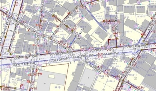
We contribute to the society in various scenes of disaster prevention connection and local government duties.


Survey service

Cartography

From high-precision aerial photography and airborne laser, to create a high-quality map data

We will create a digital map data that can be cooperation with the database to display a varity of survey data on the computer.
In addition, we also can create detailed, high-quality map along to a variety of rules.

Moreover, we will create a variety of analysis diagram in accordance with the purpose and application from the three-dimensional data obtained by the "airborne laser measurement system."


Survey service

Geographic Information System

Based on the high-precision surveying technology and rich experience, the development ability of the geographic information system

We are based on the wealth of experience related to the measurement, analysis and use of geospatial data, software development and system construction and operation for the environment, disaster prevention, and infrastructure management support and local goverment support, etc., to the needs of the client we develop the suits most appropriate GIS and software.


Survey service

Remote sensing

NAKANIHON AIR perform "environmental research" , "vegetation and land-use survey" by airborne remote-sensing  technology.

We hold various research and surveying equipments of aircraft-mounted, make the acquisition and analysis of remote-sensing data by its own fixed-wing / helicopter. Also on sale of satellite image as a distributor.
We are operating a combination of hyper-spectral measurement device (CASI-1500H) and a high-resolution thermal imaging device (TABI-1800) the "CAST" in-house aircraft.
We have also carried out environmental research by the analysis as well as data acquisition.
Nakanihon can provide spatial information solutions along the customer needs as well as intergration with the wide area of satellite data and high-definition aircraft data.


Survey service

Support of Public Works Projects for Various Government Agencies

NAKANIHON AIR digitalizes map information and provides key data, whose accuracy is relied upon by various governmental agencies, for such uses as topographical maps, roadway delineations, waterwork matrices, real property mapping, urban planning models, farmland monitoring, and natural disaster geographical shifts. We also provide business support systems which combine the individual mapping data above into unified comprehensive maps, thereby streamlining the decision making process of public works projects.